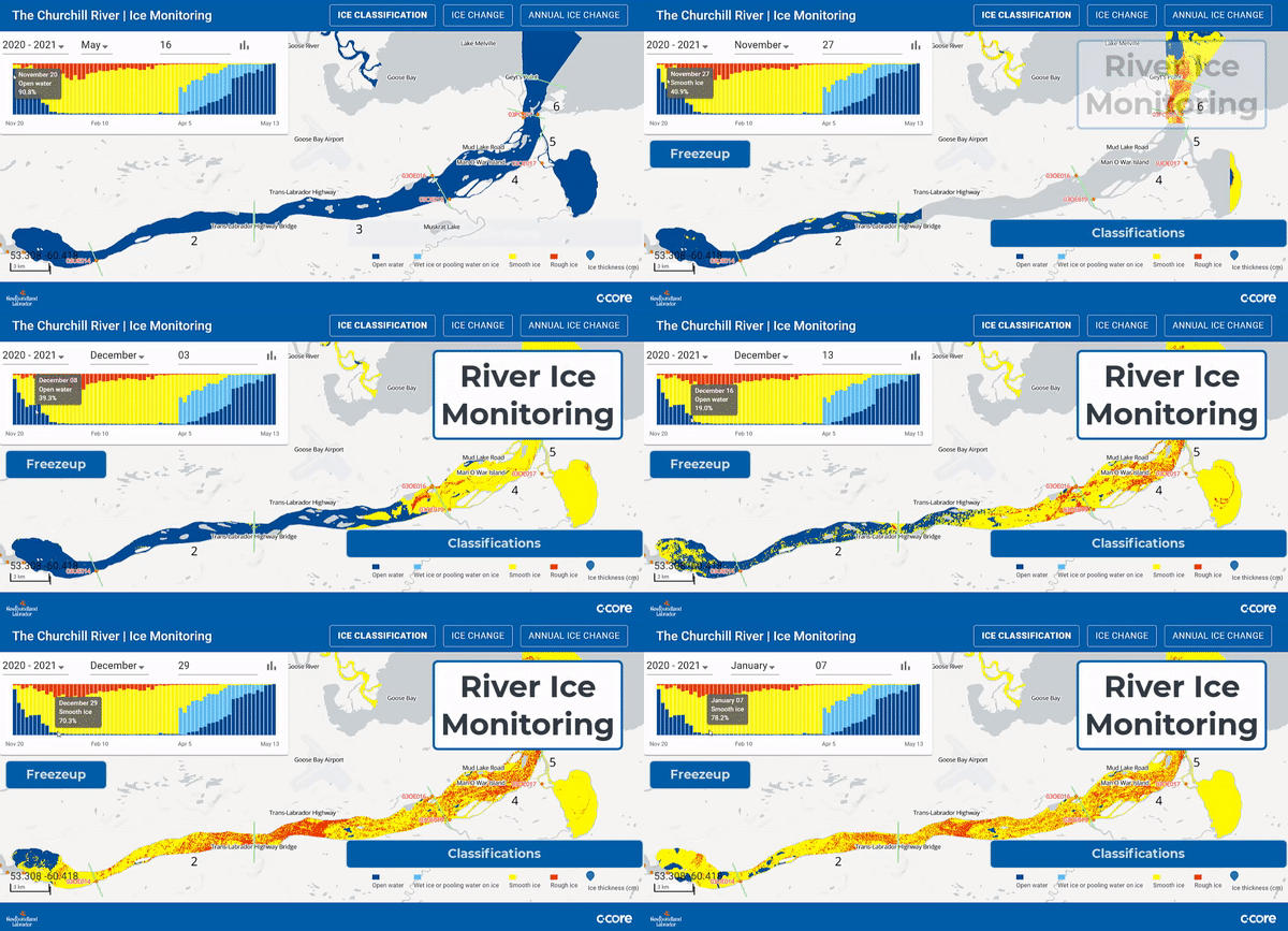

LOOKNorth's River Ice Monitoring Service leverages satellite-based imagery to monitor the ice conditions for any river on earth. Ice build-up on large rivers can pose serious challenges for:
In order to assess flood risk and mitigate its impacts, this service allows customers to monitor build-up of ice covers throughout the ice season, with particular emphasis on the freeze-up and break-up periods.
During freeze-up and/or break-up season, we download Synthetic Aperture Radar (SAR) satellite imagery up to three times a week, over hundreds of kilometers. We then process these images in near real-time, and provide the resulting information via our easy-to-use web interface. Click here to view the Churchill River interface.
Using seasonal data of the entire river, hydrologists can track the emergence of open water to help predict river break up, assess flood risk and provide proactive emergency measures for cities, businesses, and communities.
Understand how river ice changes within a season or annual change - Current ice conditions are compared with recent image analysis results to report how ice is growing, receding and melting at the surface.
Service to install and accurately monitor river thickness. C-CORE utilized SIMBA buoys to accomplish this and provides service to install seasonally as well.
No software required - automatic email/SMS updates on arrival of new products, and secure historical
backup of all data.
Creates machine readable data sets that can be easily incorporated into machine learning models.


